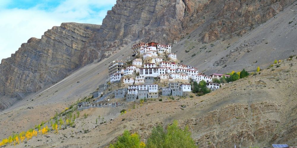
Traveling to the Spiti Valley is a dream of so many youngsters. There is no other region like the Spiti Valley. Why? It’s a region that is home to the World’s highest village and post office. Riding a bike on the roads gives an incredible experience. The mountains and sky that surround these roads make your traveling experience wonderful. Spiti’s epic landscapes await. But getting there is half the fun. To ensure your adventure is all awe and no ordeal, let’s talk about how to reach here. For a truly spectacular entrance, the road from Shimla is a traveler’s favorite.
Overview of the Journey
The distance from Shimla to the Spiti Valley is around 450 kilometers. This isn’t a journey to be rushed. It’s a two-day pilgrimage best broken with a night under the stars in Kalpa, letting the mountain silence sink in.
This journey is a living story written in landscape. It begins in the deep, emerald forests of the Kinnaur Valley. And then, it unfolds into the bright, bold stanzas of a high-altitude desert. Getting to Spiti is the goal. But believe us, the journey in the heart of Himachal Pradesh itself is the adventure you’ll remember most.
Why Choose Shimla to Spiti Valley Road Trip
One can reach this beautiful region in two ways: From Shimla or Manali. The route from Shimla is longer. But many travelers still prefer this route for its smoothness. On the other hand, the route from Manali is shorter but steeper, which travelers prefer on the way back from Spiti and Lahaul Valley.
Gradual Altitude Gain: The trip to Spiti Valley from Shimla is longer. But a gentle elevation gain makes travelers choose this route. Therefore, it’s a strategic choice for your own wellbeing.
Scenic Beauty: Every stop along the route offers a glimpse of Himachal’s beauty. From ancient villages and apple orchards to calming rivers and beautiful mountains, everything makes your journey memorable.
Better Road Conditions (Initially): The Shimla route remains the more reliable choice. Why? Simply put, the high passes from Manali are still snowed under.
Open for Longer Periods: The Manali–Kaza road remains closed during winter. However, the Shimla side usually stays open for most of the year.
Shimla To Spiti Valley Distance
The distance between Shimla and Spiti Valley is approximately 450 km. Travelers often refer to it as the ultimate Shimla-to-Spiti Valley road trip. You can choose between two main approaches: via the Shimla side or via Manali and the Spiti Valley. While the Manali to Spiti route is shorter, it’s steeper and often closed in the winter. Therefore, the Shimla side is considered the safer and more scenic option.
Detailed Shimla to Spiti Valley Route
It takes two or three days to reach the Spiti Valley from Shimla. Here’s a breakdown of the most common route from Shimla to this Valley in Lahaul and Spiti:
Shimla → Narkanda → Rampur → Reckong Peo → Kalpa → Nako → Tabo → Kaza (Spiti Valley)
Let’s understand this Spiti Valley tour better:
Shimla → Narkanda: 60 km
The real Spiti Valley trip starts where Shimla ends. What opens up before you is a road that tells a slow, beautiful tale—one of towering pines that feel like nature’s cathedrals and orchards stepping up the hillsides. And your first chapter starts in Narkanda. This quiet little town is your perfect sanctuary.
Narkanda → Reckong Peo / Kalpa: 160 km
Now move towards Reckong Peo. Feel the air warm as you descend to the Sutlej. Now, forget the clock. For 220 kilometers, your only job is to watch the light dance on the cliffs and listen to the river’s endless song. This is where the journey truly lives.
Kalpa → Nako: 110 km
From Kalpa, the road climbs higher along the Hindustan–Tibet Highway. You’ll pass through scenic villages like Puh and Khab before reaching Nako. It’s a charming village near the Spiti River. The Nako Lake is a must-visit spot here.
Nako → Tabo: 70 km
A three-hour scenic drive takes you to Tabo. It’s a beautiful region that is home to a 1000-year-old monastery. Walking its grounds is like stepping directly into Himalayan history.
Tabo → Kaza: 50 km
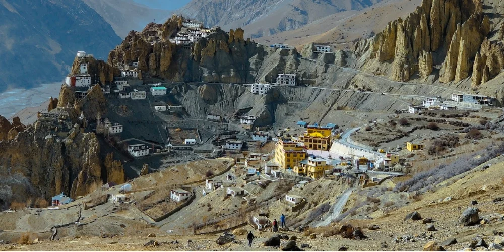
The final stretch from Tabo to Kaza takes around 2 hours. Kaza is the main town in Spiti Valley and the center for most travel and stay options. Once you reach Kaza, you’ll feel the true charm of Spiti — with its barren mountains, monasteries, and cold desert beauty. A short drive from here leads to Pin Valley.
Modes of Transport from Shimla to Spiti Valley
There are several ways to travel from Shimla to the Spiti Valley, depending on your budget and travel style.
1. By Car or Bike
Love riding bikes? Then, fulfill your dream by renting a bike or a car to cover the route. Many people prefer this kind of Spiti road trip, especially those who love freedom and mountains. But make sure your bike can handle rugged terrain.
2. By Bus
If you prefer public transport, buses from Shimla to various points along the route are available.
- Shimla to Reckong Peo: Regular HRTC buses run daily.
- Reckong Peo to Kaza: There is a direct HRTC bus that leaves early in the morning and reaches Kaza by evening.
Though the journey can be long, it’s budget-friendly and perfect for travelers who want to experience local life.
3. By Taxi or Shared Cab
You can also hire a taxi from Shimla or join a shared cab. Taxis offer more comfort and flexibility than buses but are costlier. Shared cabs, often used by locals, are cheaper but may be crowded.
The Best Time to Visit
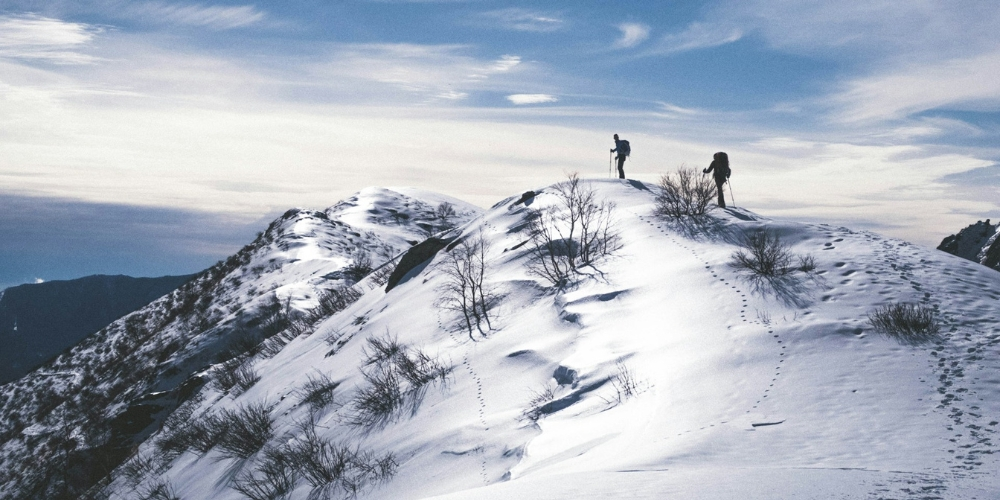
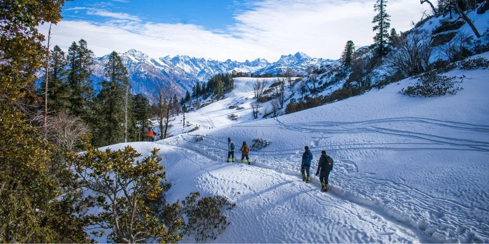
The Spiti Valley is ranked among the top snowfall places in Himachal Pradesh. Let’s know when you can visit this place:
| Season | Timeframe | Recommended? |
|---|---|---|
| Ideal Visiting Window | May – October | ✅ Yes |
| Peak Season | June – September | ✅ Yes (Best) |
| Winter | November – April | ❌ No |
Final Thoughts
Sometimes the journey really is the best part. Spiti Valley is a marvel. But the ride there, primarily via Shimla, is an adventure you’ll never forget. Come and see for yourself. Let the wild beauty of the landscape do the rest. We hope this comprehensive travel guide has been helpful to you. So, what are you waiting for? Explore the top Spiti tour packages and visit Spiti Valley with your friends today!